


Voting District 1000000, Suffolk County, New York
About
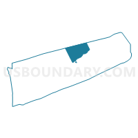
Outline

Summary
| Unique Area Identifier | 637081 |
| Name | Voting District 1000000 |
| County | Suffolk County |
| State | New York |
| Area (square miles) | 133.70 |
| Land Area (square miles) | 0.00 |
| Water Area (square miles) | 133.70 |
| % of Land Area | 0.00 |
| % of Water Area | 100.00 |
| Latitude of the Internal Point | 41.11176060 |
| Longtitude of the Internal Point | -72.52654000 |
Maps


Graphs
Select a template below for downloading or customizing gragh for Voting District 1000000, Suffolk County, New York


Neighbors
Neighoring Voting District (by Name) Neighboring Voting District on the Map
- Voting District 0600000, Suffolk County, NY
- Voting District 0600016, Suffolk County, NY
- Voting District 1000002, Suffolk County, NY
- Voting District 1000004, Suffolk County, NY
- Voting District 1000005, Suffolk County, NY
- Voting District 1000007, Suffolk County, NY
- Voting District 1000008, Suffolk County, NY
- Voting District 1000009, Suffolk County, NY
- Voting District 1000010, Suffolk County, NY
- Voting District 1000013, Suffolk County, NY
- Voting District 1000016 1000018, Suffolk County, NY
- Voting Districts not defined, Middlesex County, CT
- Voting Districts not defined, New Haven County, CT
Top 10 Neighboring County Subdivision (by Population) Neighboring County Subdivision on the Map
- Riverhead town, Suffolk County, NY (33,506)
- Southold town, Suffolk County, NY (21,968)
- County subdivisions not defined, Middlesex County, CT (0)
- County subdivisions not defined, New Haven County, CT (0)
Top 10 Neighboring Place (by Population) Neighboring Place on the Map
- Southold CDP, NY (5,748)
- Mattituck CDP, NY (4,219)
- Cutchogue CDP, NY (3,349)
- Greenport West CDP, NY (2,124)
- Northville CDP, NY (1,340)
- East Marion CDP, NY (926)
- Peconic CDP, NY (683)
Top 10 Neighboring Unified School District (by Population) Neighboring Unified School District on the Map
- Riverhead Central School District, NY (38,457)
- Mattituck-Cutchogue Union Free School District, NY (9,193)
- Southold Union Free School District, NY (6,332)
- Greenport Union Free School District, NY (4,484)
- Oysterponds Union Free School District, NY (1,605)
- School District Not Defined (Water), CT (0)
Top 10 Neighboring State Legislative District Lower Chamber (by Population) Neighboring State Legislative District Lower Chamber on the Map
Top 10 Neighboring State Legislative District Upper Chamber (by Population) Neighboring State Legislative District Upper Chamber on the Map
Top 10 Neighboring 111th Congressional District (by Population) Neighboring 111th Congressional District on the Map
Top 10 Neighboring Census Tract (by Population) Neighboring Census Tract on the Map
- Census Tract 1702.01, Suffolk County, NY (5,748)
- Census Tract 1700.01, Suffolk County, NY (5,613)
- Census Tract 1699.02, Suffolk County, NY (5,488)
- Census Tract 1700.02, Suffolk County, NY (4,381)
- Census Tract 1702.02, Suffolk County, NY (4,029)
- Census Tract 9901, Suffolk County, NY (0)
- Census Tract 9901, Middlesex County, CT (0)
- Census Tract 9900, New Haven County, CT (0)
Top 10 Neighboring 5-Digit ZIP Code Tabulation Area (by Population) Neighboring 5-Digit ZIP Code Tabulation Area on the Map
- 11901, NY (27,172)
- 11971, NY (5,818)
- 11952, NY (4,637)
- 11944, NY (4,299)
- 11935, NY (3,304)
- 11939, NY (926)
- 11958, NY (635)